Chicago-Calumet River System Mapping
Flowing and meandering through urban and suburban communities, forest preserves and parks, industrial and commercial districts, as well as the heart of downtown, the 156-mile long Chicago-Calumet River system and the watersheds that surround it are highly varied. Through in-depth mapping, Friends’ staff seeks to understand this diverse geography to drive understanding of its value and immense potential.
Friends collects, manages, and shares watershed mapped information using Geographic Information Systems (GIS). The GIS maps and tools that Friends creates help our organization internally to inform where and how we focus our efforts, and externally to help people visualize and understand our vision for a healthy and continuously connected blue-green river corridor that supports the needs of all people, water, and wildlife. We also share this comprehensive data analysis with agency, non-profit, and government partners to ensure that future river policies, plans, and projects are well informed. Below are links and summaries of some of our map resources.
Please contact Amy Heldman, Friends’ senior planner and GIS manager at aheldman@chicagoriver.org for any questions about our GIS work.
EXPLORE THE WATERSHED MAP DATA HUB
This map is a compilation of river related reference layers including demographic information, stormwater infrastructure, and wildlife data that we have collected from partners and created ourselves.
VIEW THE MAP FULL SCREEN HERE.
HABITAT CONNECTIVITY ACTION PLAN

This biodiversity focused initiative aims to identify specific projects, strategies, and opportunities to restore a network of connected healthy urban habitat throughout the watershed. Explore the full story map here and view our webpage on it here.
THE NATURAL SOLUTIONS TOOL

The Natural Solutions Tool emerged from a vision for more strategic and collaborative watershed-wide investments in multi-beneficial nature-based solutions set by the Greater Chicago Watershed Alliance, a coalition launched by Friends of the Chicago River in 2020. Tool development was led by The Trust for Public Land with input from Watershed Alliance members and numerous other partners. The Tool was first launched in 2023 and is updated annually. Explore the tool here.
RIVER SHALLOWS STORYMAP
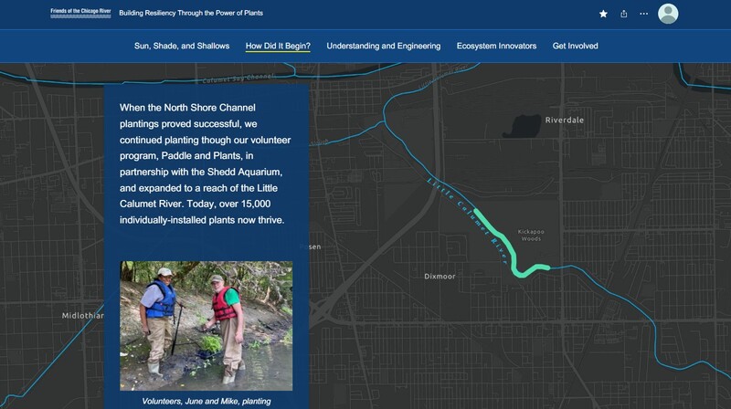
In 2015 Friends began installing thousands of native plants along riverbanks to create healthy homes for animals, stabilize river shorelines, and increase river and community resiliency against the impacts of climate change. From 2024 - 2025 thanks to a grant from the National Fish & Wildlife Foundation, we investigated at the entire Chicago-Calumet River system's edges to find new plant locations and scale up this proven strategy that benefits our rivers and human and animal communities.
To learn more about our project to harness the power of nature to offset the impacts of the climate crisis and build resilience through the application of sun-loving water willow (Justicia americana) and shade-loving lizard’s tail (Saururus cernuus) - view our interactive ArcGIS Storymap here.
RIVER EDGE DEVELOPMENT TRACKING MAP

Friends’ River Edge Development Tracking Map is used to track ongoing developments throughout the Chicago-Calumet River system. This is a key tool for advocacy that our planning team maintains regularly. View more on our river edge development advocacy here.